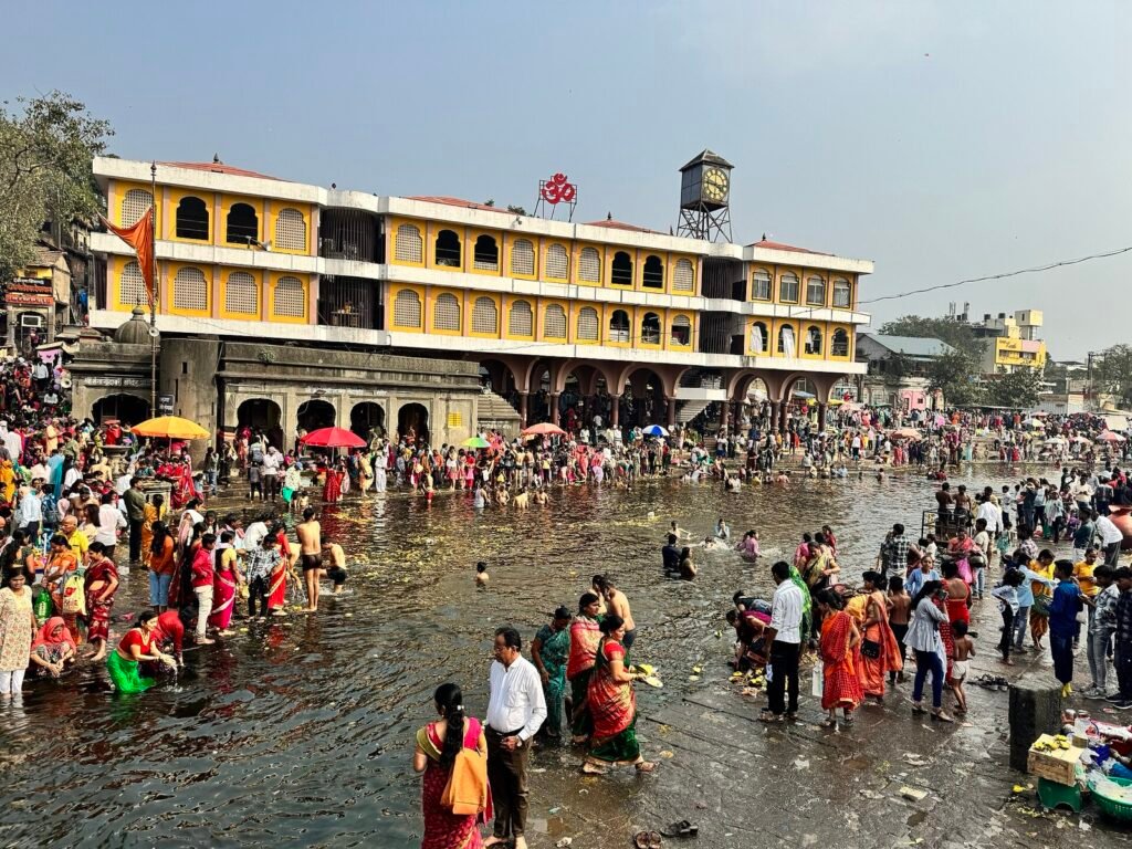
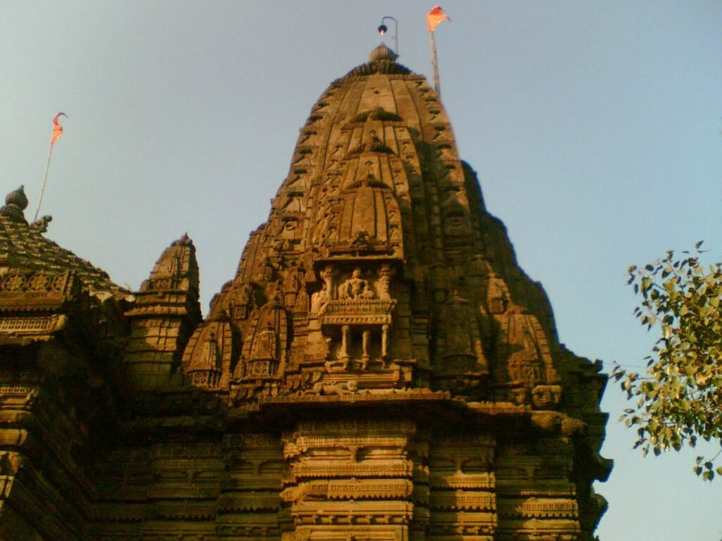
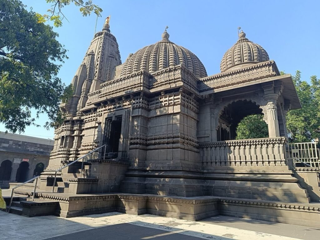
The Godavari ghats, Nashik. Photo: MayurFreelancer, CC BY-SA 4.0, via Wikimedia Commons
Nashik–Trimbakeshwar Simhastha · Places
The Godavari Ghats of Nashik Beyond Ramkund
KMKumbhMela.info Editorial TeamChecked on Fri 16 Oct 2026
Ramkund is the Simhastha's bathing centre in Nashik, but it is one of many ghats and kunds on the Godavari in the city. The Kumbh Mela Authority's plan of 15 June 2026 maps 12 existing ghats in Nashik, about 5,831 metres in all, and proposes 10 more.
EvergreenChecked on Fri 16 Oct 2026
Ghat names are from the Kumbh Mela Authority's plan of 15 June 2026, which the authority marks as interim, and from its list of administrative approvals. The old kunds are as recorded in the 1883 Bombay Gazetteer and may have changed since. Plan items and approvals are works in progress, not finished ghats. Ghat allocation, entry and timings for 2027 are not announced.
The plan says the Kumbh snan is held at Ramkund and other ghats. Which ghats will be open to pilgrims on the 2027 Amrit Snan days is not announced.
Nashik's ghats at a glance
Where
Along the Godavari in Nashik city, from Someshwar in the west to Odha in the east, on the authority's 2027 ghat map.1
River and bank
The Godavari, on both banks. The plan maps 12 existing ghats of about 5,831 metres and proposes 10 more.1
Known for
A chain of old stone kunds in the riverbed beside Ramkund, many built by Peshwa-period patrons, as the 1883 Gazetteer lists them.2
Steps and access
Not published yet. The plan marks ghat amenities such as holding areas and changing rooms as tentative.
Nearest official help point
Not published yet. The authority's plan lists a digital lost and found among its tentative components for 2027.3
Kumbh 2027 status
Amrit Snans in Nashik on 2 August, 31 August and 11 September 2027. Which ghats open to the public is not announced.3
On a Kumbh day
The authority's plan says the Kumbh snan is held at Ramkund and other ghats; which ghats open on each 2027 Amrit Snan is not announced.
At the first shahi snan of 2015, on 29 August, the Digambar akhara bathed at Ram Kund and Ram Ghat from 8 am, PTI reported.
On 24 July 2026 the Godavari crossed the danger mark in Nashik and small temples at Ramkund and Goda Ghat went under water, PTI reported. The Simhastha falls in the monsoon.
In the old city, the Godavari’s bed holds a chain of stone pools, or kunds, many built by patrons of the Peshwa period. The 1883 Bombay Gazetteer lists them in order downstream, from the steps of the Sundarnarayan temple to the Mukteshvar shrine. Names, shapes and use may have changed since 1883.
Kund
What the 1883 Gazetteer says
Lakshman Kund
The first pool, said to have been made in 1758 by Sarsubhedar Mahadaji Govind Kakde; believed to hold a spring
Dhanush Kund (the bow pool)
A narrow channel leading from Lakshman Kund to Ramkund
Ramkund
The holiest spot in Nashik, where Rama is believed to have bathed; it holds the Asthi Vilaya tirth
Sita Kund
A small pool just north of Ramkund, built by Gopikabai, mother of the fourth Peshwa
Ahilyabai Kund
Built by Ahilyabai of Indore towards the end of the 18th century, in front of her temples
Gora Ram or Dashashvamedh Kund
A large pool in front of the Nilkantheshvar and Gora Ram temples
Ramgaya Kund
In front of the Naroshankar temple; by tradition, Rama performed his father’s funeral rites here
Peshwa Kund (Shintode Mahadev)
Where several small streams meet the river; its Nashik side was built by Peshwa Bajirao I (1720 to 1740)
Mukteshvar Kund
The last pool, in front of the Mukteshvar shrine, built in 1788 and held to be specially holy
The Gazetteer also notes that the small temples and shrines facing these pools, on both banks, go fully under water in floods. Ramkund’s own history is on our Ramkund page.
What you do here
The Godavari at Panchavati, Nashik. Photo: Saket Verma, CC BY-SA 4.0, via Wikimedia Commons
The dip
The authority's plan says the Kumbh snan is held at Ramkund and other ghats. Which ghats are open to the public on each Amrit Snan day is not announced.1
Temples on the Godavari steps, Nashik. Photo: Mahi29, CC BY-SA 4.0, via Wikimedia Commons
The old kunds
The 1883 Gazetteer lists the pools downstream from Sundarnarayan's steps: Lakshman Kund, Dhanush Kund, Ramkund, Sita Kund, Ahilyabai Kund and others, ending at Mukteshvar Kund. They may have changed since.2
The plan’s ghat map for Nashik marks existing ghats and proposed ghats along the river, from Someshwar in the west to Odha in the east. The table gives the names as the map shows them, with related works from the authority’s list of approvals.
Ghat
In the plan’s map
Related approved work
Gandhi Talao
Existing
None listed by name
Talkuteshwar (west and east)
Existing
Conservation at the Talkuteshwar temple was reviewed in August 2026 (Free Press Journal)
Laxminarayan Ghat
Existing, plus a proposed new ghat
Laxminarayan Ghat is among MSIDC works in the plan’s Phase II list
A ghat on the right bank above the Godavari–Nandini confluence; a ghat at Takli on the left bank; a rubber (balloon) dam below the confluence
Nandur Manur and Dasak
2 existing, plus 2 proposed
Ghats at Nandur and Dasak, upstream of Dasak bridge (about ₹111.90 crore)
Anandwali
2 existing, plus 1 proposed
A new ghat at Anandavalli, in place of an earlier ghat work near Navshya Ganpati
Someshwar Waterfall Ghat
Proposed
Someshwar Ghat is among MSIDC works in the plan’s Phase II list
Odha Ram Ghat
Proposed
Odha Ghat on the left bank at Odha (about ₹27.43 crore)
An approval shows that a work has been sanctioned. It does not show that a ghat is finished, or that it will be open to the public on a given day. The plan marks the amenities it lists for ghats, such as holding areas, changing rooms and lost and found centres, as tentative.
Photo: Mahi29, CC BY-SA 4.0, via Wikimedia Commons
Godavari ghats and the old bridge, Nashik
Heritage works on the riverfront
The authority’s approvals include restoration of temples and tanks through the Archaeological Department: 13 works, 5 of them in Nashik city and 8 in the Trimbakeshwar area. The list does not name the sites.
On 3 August 2026, the state’s Cultural Affairs secretary reviewed conservation, restoration and development works at heritage sites, including the Naroshankar temple, the Sundarnarayan temple and ghat, Indra Kund and the Talkuteshwar temple, the Free Press Journal reported. He asked for the work to be finished well ahead of the Simhastha.
The Nashik Municipal Corporation has approval for repair works on old ghats, about ₹44.04 crore. Which ghats these cover is not given in the list.
Photo: Prashant Kharote, CC BY-SA 4.0, via Wikimedia Commons
A misty morning at Godha Ghat on the Godavari in Nashik, with a stone temple pavilion on the bank
Trimbakeshwar's ghats
At Trimbakeshwar, the Simhastha’s bathing centre is Kushavarta. The plan’s map for the town also names Ahilya Ghat, Shrinath Ghat and Shri Chandra Ghat, and gives 4 existing ghats of about 1,005 metres and 2 proposed ghats of about 3,140 metres.
The plan proposes developing and extending Ahilya Ghat, Shri Chandra Ghat and Shri Nath Ghat. The approvals include new ghats on both banks of the Godavari at Trimbakeshwar, and land for new ghats from Shri Chandraghat to Prayagtirth.
Photo: Studio Gestalt, CC BY-SA 4.0, via Wikimedia Commons
Kushavarta Kund in Trimbakeshwar town, where the Simhastha baths are held
High water, and what is not announced yet
The 2027 Simhastha falls in the monsoon, and the riverside can be closed when the Godavari runs high. On 24 July 2026 the river crossed the danger mark in Nashik, small temples at Ramkund and Goda Ghat went under water, and the Ramkund area was to stay closed for two days, PTI reported. Follow the Nashik district’s river-level alerts and police instructions at the ghats.
Amrit Snan days usually draw the most pilgrims; follow police and mela instructions on the day.
Which ghats will be open to the public on each Amrit Snan day
Which ghats are set aside for the akhara processions, and at what times
Entry and exit routes to each ghat
Whether the new ghats will be finished before the Simhastha
In pictures
Morning at Godha Ghat, Nashik. Photo: Prashant Kharote, CC BY-SA 4.0, via Wikimedia CommonsTemples on the Godavari steps, Nashik. Photo: Mahi29, CC BY-SA 4.0, via Wikimedia CommonsGodavari ghats and the old bridge, Nashik. Photo: Mahi29, CC BY-SA 4.0, via Wikimedia CommonsThe Godavari at Panchavati, Nashik. Photo: Saket Verma, CC BY-SA 4.0, via Wikimedia Commons
Where it is
Nashik: Panchavati ghats, Tapovan and arrival points
1Ramkund and PanchavatiGhat · This page
2TapovanPlace
3Nashik Road railway stationRailway
4Mela bus standBus
5Nimani bus stationBus
A guide to where places are, not a route plan. During the mela, roads and ghats open and close by the official plan; follow police and mela directions.

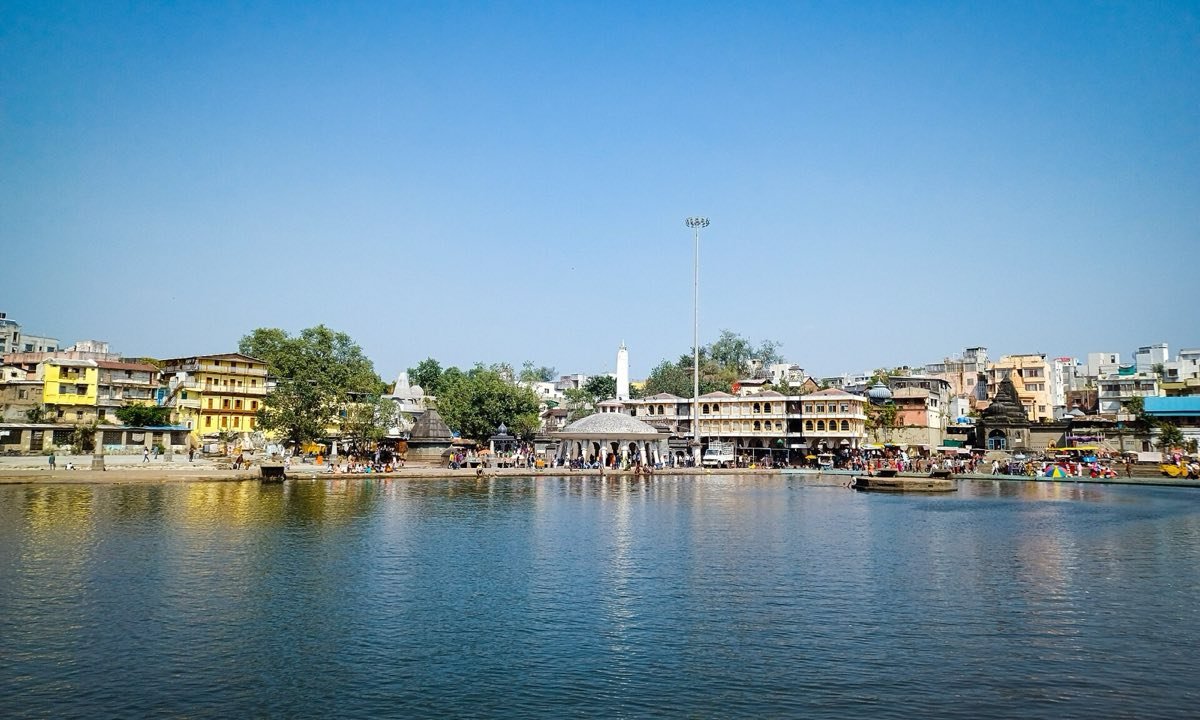
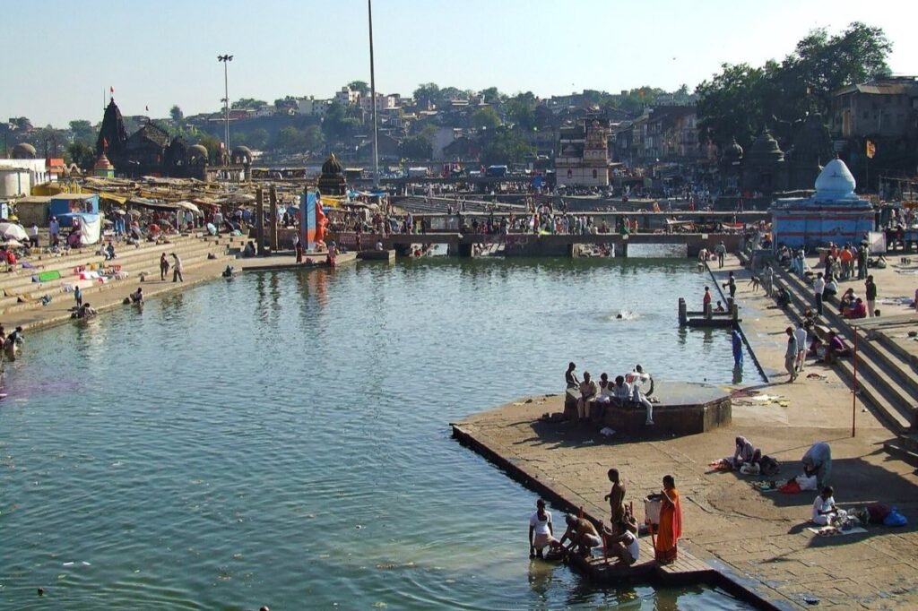 The Godavari at Panchavati, Nashik. Photo: Saket Verma, CC BY-SA 4.0, via Wikimedia Commons
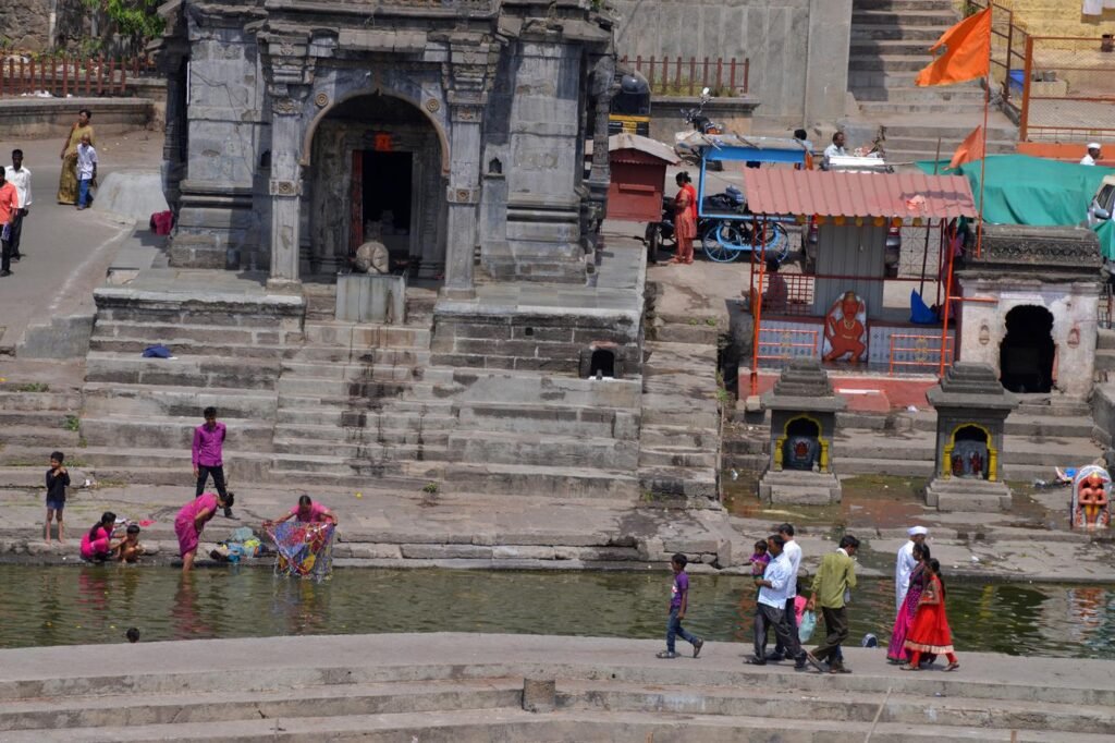 Temples on the Godavari steps, Nashik. Photo: Mahi29, CC BY-SA 4.0, via Wikimedia Commons
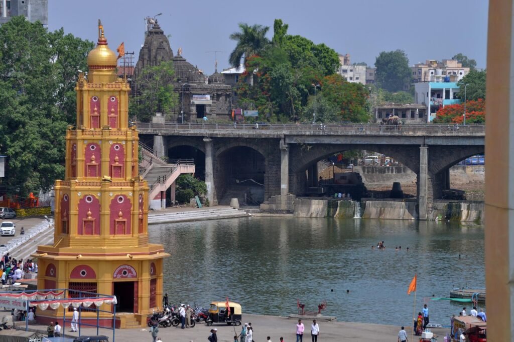 Photo: Mahi29, CC BY-SA 4.0, via Wikimedia Commons
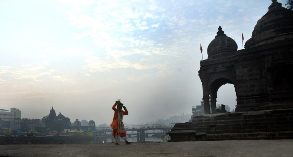 Photo: Prashant Kharote, CC BY-SA 4.0, via Wikimedia Commons
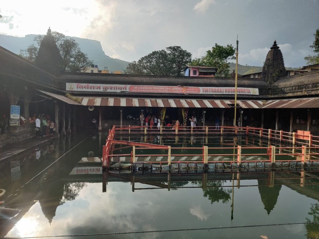 Photo: Studio Gestalt, CC BY-SA 4.0, via Wikimedia Commons